Saturday, May 30, 2015

Costa Ricas Natural Hazards

Although Costa Rica is beautiful, it can sometimes be a scary place. Earthquakes, volcanoes, landslides and flooding are all too common for such a small place. But from all these, earthquakes are too fear the most.

Earthquakes occur almost every day due to the fact that Costa Rica lies between two tectonic plates: the Carribean plate and the Coicos plate. These two plates push and shove each other causing small tremors throughout which can cause landslides and volcanic eruptions.  Most of these tremors are rarely felt on a daily basis, but once in a couple years Costa Rica experiences quakes with devastating results.


The most recent quake (in  September 5, 2012) is the second strongest recorded with a magnitude of 7.6 on the Richter scale. This quake was so strong that Nicaragua, El Salvador and Panama felt the movement and aftershocks were still being felt 5 days after with an aftershock measuring at 5.7! Although this quake was huge, other than building being shaken down, only two deaths were recorded.


The strongest earthquake recorded occurred in 1991 with a measure of 7.6 on the Richter scale. This earthquake left 4 dead and buildings as well as bridges and road were completely destroyed.


Now, earthquakes cannot be predicted so the best we can do to prepare for one is to have buildings that follow guidelines on safety and can withstand some shaking and knowing what to do if an earthquake strikes. I think most of us already know that finding cover during a shake is a must as is having an emergency kit ready. Emergency kits should contain food and water for a few days as sometimes water can become contaminated.

If another Earthquake occurs, the coastal cities would be the most affected ones as they are closer to the plates. These coastal cities should be the first to obtain emergency help. To be safe, in my opinion, no houses should be build near the coast as sometimes high intensity earthquakes may cause tsunamis and flooding. Houses should be build more inland where the ground in more stable and able to withstand the shaking.


Since these tectonics plates are in the ocean, coasts have greater danger of being affected.


http://www.centralamerica.com/cr/moon/moland.htm
http://en.wikipedia.org/wiki/2012_Costa_Rica_earthquake
http://earthquake.usgs.gov/earthquakes/world/events/1991_04_22.php
http://en.wikipedia.org/wiki/1991_Limon_earthquake
https://www.fema.gov/earthquake-safety-home

Sunday, April 26, 2015

Cyclones

Costa rica lies between the Pacific and Atlantic ocean so one would expect extreme weather such as hurricanes to happen often but that is not the case.  Although it rains from May to November, only September and October typically bring the tropical thunderstorms.


These storms tend to bring in high waves (sometimes as high as 70ft.) and non stop heavy rain for hours at a time causing landslides and flooding.  Some areas of Costa Rica receive up to 110 inches of rain during these months.


Sources:

Saturday, April 18, 2015

Sinkholes

One would expect Costa Rica to be plagued by sinkholes because of the amount of seismic activity it experiences but sinkholes in Costa Rica are not a common sight.  The last major one opened up in 2012 due to continuous storms, and it took about three weeks to patch up the 3.5m(l) x 4m(d) hole.


Small sink holes tend to happen only when the country has experienced heavy rainfall or high  magnitude earthquakes occur.


Sources:
Sott.net

Friday, April 10, 2015

Land Slides

Costa Rica tends to have various land slides yearly due to the seismic activity this country experiences. Land slides also tend to happen because the country has a lot of strong rains and storms throughout the year. Researched have a pretty accurate map of where the soil is "weak" and land slides have a high risk of happening, yet people, specially low income indiiduals, build near these areas putting themselves at risk.

Right now researchers are trying to set up better building codes to protects individuals from these land slides. They are also trying to ban the construction of buildings near any bodies of water where the ground is softer making land slides more likely to occur,


Here are a couple videos:
(The first one is in Spanish, but the images tell it all.)


This video here talks about how Costa Rica plans to prevent futute land slides with their Perrilla Module.


sources:

We Love Costa Rica
Tico Times
News.Co


Saturday, March 14, 2015

Tsunami

Costa Rica has a high chance of having a tsunami because of its location on the Caribbean plate.  The Caribbean plate experiences a large amount of earthquakes regularly which can sometimes trigger large tides.  Earthquakes in surrounding areas could also cause tsunamis depending on the magnitude of the earthquake and the distance between Costa Rica and the earthquake epicenter.


Because of the high tsunami threat the government has established some preventative measures and alerts.  The Pacific Tsunami Warning Center monitors the geographical problems and if there is an issue, the media is then alerted to help spread the message to the public.


Sources:
Tico Times
Costa Rica Wikipedia

Saturday, March 7, 2015

Volcanos

Costa Rica is not only known for their earthquakes, but for their volcanos too.  Costa rica is home to 67 volcanos of which 5 are currently active.

The  IrazĂș volcano is Costa Ricas largest and most active volcano in the country with a height of 11,260ft.  This volcano homes several active craters as well. The largest crater is about 900ft deep.  This volcano last erupted in 1963 but still remains active.  


The Rincon De La Vieja volcano is part of a collection of 9 craters that dot the Rincon De La Vieja national park and is well known for its hot springs.  This collection of volcanos was most active in the late 90's, of these 9 the Von Seebach is currently active by venting stream and micro eruptions occasionally.


The Tenorio volcano is the fourth largest in the country with a height of 6,286ft.  The bookmarks surrounding area is enchanting with its blend of forestry, hot springs, and geysers.

Lastly, the Turrialba volcano is the second tallest in the country with a summit peaking at 10,919ft.  Turrialbas last major explosion was in 1866, but since then smoke keeps being released.


Because Costa Rica has a high volume of volcanos, the country has implemented two early warning systems for eruptions.  One of these systems is using seismographs to monitor volcanic activity.  These seismographs are monitored by Oviscori-Una, which is a seismic monitoring program run by the volcanological and seismological Observatory of Costa Rica.  These seismographs allow researchers to monitor volcanic activity.  The other early warning system is simple human lookout.  Volunteers are sent to monitor various areas and its activity.  In addition there are several institutes helping to monitor volcanic activity as well.


Sources:


Friday, February 27, 2015

Seismic Activity

Costa Rica has a lot of seismic activity because it lies withing two tectonic plates. it is typical for Costa Rica to experience earthquakes almost daily. Some are only a few seconds and can be barely felt while others are stronger and lasting a couple minutes.
Costa Rica tends to experience more seismic activity in subduction zones. Earthquakes in these zones have been measured up to 8.5 in the Richer scale.

HERE is a great site where you can see seismic activity in Costa Rica.

In the past 30 days Costa Rica has had 6 Earquakes ranging from 2.4 to 4.5 on the Ritcher Scale.
In 2012 Costa Rica had its biggest quake in recent years. This quake had a 7.6 magnitude, and an after shock measuring in at 6.6M.


To prevent catastrophes after an earthquake Costa Rica has building codes,and a minimal use of gas pipes to prevent fires. Costa Rica also has a plan to keep their water supply clean after a natural disaster to prevent the spread of diseases after a catastrophe.


Costa Rica: volcanoes and recent earthquakes - interactive map / VolcanoDiscovery


Sources:
The Land of Costa Rica
Earthquake Track
Volcano Discovery
ECPRA
Costa Rica Guide
Wikipedia


Friday, February 20, 2015

The Caribbean Plate

Costa Rica lies on the Caribbean Plate which predominates the Cocos plate. Because these two plates shift often Costa Rica experiences a lot of seismic activity including some tsunamis. These plates are also the cause for volcanoes.T he Central America Volcanic Arc is formed here. This arc extends from Costa Rica to Guatemala.

The Caribbean Plate is bordered by two major plates, and two minor plates.


Click here to see daily seismic activity in Costa Rica

Sources:

Thursday, February 12, 2015

Resources (Minerals and/or Rocks)

With a name like Costa Rica one would think that this republic would be rich in natural resources, but that is in fact not true. Costa Ricas land and climate are in fact its more richest natural resources. Some minerals are to be found, but there are not many.

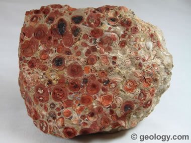
1.Bauxite Deposits
Bauxite deposits are found in the General and Coto Brus Valleys.
Bauxite is used in the production of aluminium.

 Click for more info

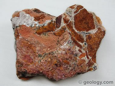
2.Copper
Copper can be found in the Corillera de Talamanca.

 Click to learn more

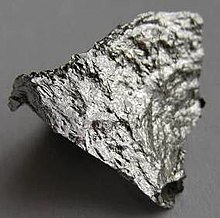
3. Manganese (Element)
Manganese is found on or near the Nicoya Peninsula.

 Click to learn more

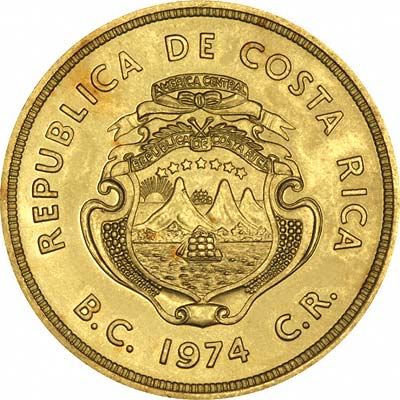
4. Gold
Gold, though extemely rare, can be found on the Osa Peninsula and parts of the Pacific slopes.

 Click to learn more


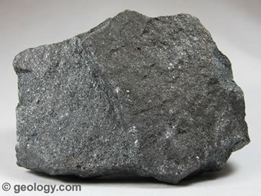
5.Magnetite 
Magnetite is found scattered throught the beaches of Costa Rica, but particularly in the Souther Caribbean Coast.

 Click to learn more


Sources: